The Story behind the trail
The Huu-ay-aht, Ditidaht and Pachendaht First Nations have always lived along Vancouver Island's west coast. These nations used trail and paddling routes for trade and travel long before foreign sailing ships reached this region over 200 year ago. Over the century following contact sailors brought the beginning of a changing world to the First Nations. Trade increased, and many sailing ships met a tragic fate navigating in these unfamiliar and hazardous waters. Sailors soon referred to this coastline as the "Graveyard of the Pacific".
Between 1888 and 1890 the government erected a telegraph line along the coastline. The line was an attempt to establish communications between the west coast villages, the newly established Cape Beale and Carmanah lighthouses, and larger communities in hopes of saving mariner lives.
However, after the wreck of the Valencia in 1906, with the loss of 133 lives, the public demanded the government do more to help mariners along this coastline. In response the government built Pachena Lighthouse, established lifesaving stations and improved the telegraph route to become a life saving trail for shipwreck victims and their rescuers. With improvements to technology the frequency of shipwrecks decreased and the life saving trail was gradually abandoned. In 1973 the trail became part of the newly established Pacific Rim National Park Reserve. Today, hiking the West Coast Trail is about exploring Vancouver Island's temperate rain forest and rugged coastline, seeing the remnants of past stories and walking in the footsteps of shipwreck victims and the First Nation people that continue to call this area home.
Then . . .
I was first introduced to the West Coast Trail (WCT) in 1989, at the age of 17. My Venture Scout troop decided our summer adventure would be a trail none of us had heard of but we're told was exceptional hard. We hiked the trail in 4 hiking days with a Sabbath rest day in between which was quick but as I remember we were young and in great shape so we averaged 15 to 20 km days. This was in the days of external frame packs and heavy everything. I believe my pack was 65 lbs, 41% of my then total body weight.
Full of mishaps and challenges, day one started with dropping the poles to our tent into the ocean as we we're loading our gear into the ferry. This posed a shelter problem but we decided we had a couple small tarps and rope and how wet could it possibly get, thankfully we chose a week that was abnormally dry. One other discovery my cousin and I made was that hammocks were the only way to sleep when on the trail, we had purchased cheap $5 netted hammocks from Canadian Tire on a whim and thought we we're pretty smart when everyone else was sleeping on the wet sand.
In 2011, at 40, I decided it was time to rediscover the now much more popular WCT, so I challenged three friends and their wives to join me and my wife to hike the 75km trial. The 8 of us faced and conquered the trail but found it harder then expected, there we're warnings but we felt we we're able and may have underestimated what we we're in for. Our packs were lighter but not by much, they started out at around 35 - 40 lbs each including food and water, however after all the rain and wet they were more like 45 - 50 lbs.
We hiked the trail in 6 hard days and were thoroughly beaten by the end, as a reward for coming with me on this hike Kathy lost 6 of her 10 toe nails and feet that were completely covered in blisters, I'm not sure how long it will really take for her to forgive me, but these reports and others are probably why this last go was a solo trip.
And Now . . .
Solo
As stated in the title, this last trip was solo, everyone scheduled to go with me one by one backed out and I soon found myself looking at facing something I was completely committed to alone. Yes I was a little nervous but not enough to forgo my plans, I was determined and for those that know me I am not easily swayed once my mind is set.
Hiking alone was different and kinda lonely which may be the reason I finished the trail 2 days sooner then I planned, but I also found that alone I was not tied down to hiking another's pace and rather enjoyed pushing myself to hike the way I felt comfortable. As stated I finished the trail 2 days early, I planned for 7 days and finished in 5. Had day one been an earlier start, I'm convinced 4 days would be sufficient, maybe next time.
From Back Breaking Back Packer to Ultralite Hiker
After the last time I hiked the WCT I swore I'd never hike again with unneeded weight on my back. Over the last two years I have studied a relatively new movement in back packing called ultralite hiking. To be considered ultralite, the base weight of one's pack must be no more then 10 - 12 lbs. By base weight I mean everything other then consumables, consumables meaning food, water, fuel, and anything that will get lighter as you use it. This took me some time to accomplish but I did it at 12lbs for a 7 day hike. In future entries I may go into detail on some of the items I have found most useful as well as those that left me wanting. Now a low base weight is key but in order to be as light a possible its also important to keep your consumables as low as possible as well. I was able to keep my over all pack weight, base and consumables, below 24 lbs. It all worked out to 9 lbs food and fuel, 3 lbs water (1.5 litres), and 12lbs base. First day my pack was 24 lbs, last day my pack was just over 12.
Returning to The Trail with a Hammock
Over the last two years, I have searched and found that hammock camping has evolved into a real deal thing since 89', in fact there are quite a few companies that specialize in hammock camping equipment, more on that in another entry.
In preparation for my hike I had heard that because of the camp sights on the trail it was a challenge to find perfect places to hang a hammock. Here in Alberta we have perfect trees to hammock camp, however on the BC coast if there are trees on the beach they are quite large and can be hard to get your straps around. Because of these types of reports I was tempted not to take my hammock which for me would be sad because I have truly fell in love with sleeping in my hammocks while camping. After telling a few of my friends of my plan to camp in a tent they convinced me that I had to stay true to my hammock commitment, so I decided to go for it and if I couldn't find a good spot I could just sleep under my tarp and brave a sandy bed. As it turns out I was able to find a spot to hang every night. It should be noted that I was alone in my hanging and it worked out but I'm not sure it would be very easy if there were someone else competing for spots. Thankfully I had no competition, however I did have some jealous on lookers. As nice as sleeping on soft sand is, it's no cozy hammock.
2013
Day 1 (Victoria)
It all started with my flight to Victoria 7:15 am, which happened to take 2 hours longer then planned due to over cast skies, in fact our direct flight had to drop into Vancouver for a refill before we could eventually land in our desired location. After landing I caught the shuttle to my room at the Helm's Inn which was excellent and nicely located to the bus depot for the trail bus.

After spending a beautiful day in Victoria, BC, I was ready to get on the trail the next day.
Day 2 (Pachena - Darling River 14 kms)
6:15 am to catch the bus that takes me to the trail head in Pachena Bay (the north end of the trail) a 5 hour drive along the worst road ever made.

After the 5 hour nightmare an orientation is mandatory before you can start your hike, it is required to complete registration and to receive your permit. The orientation provides info on the current conditions of the trail and a run down of the rules for hiking in the park.
 |
| Pachena Trailhead |
 |
| Pachena Bay's Beach Trailhead |
 |
| Pachena Light House |
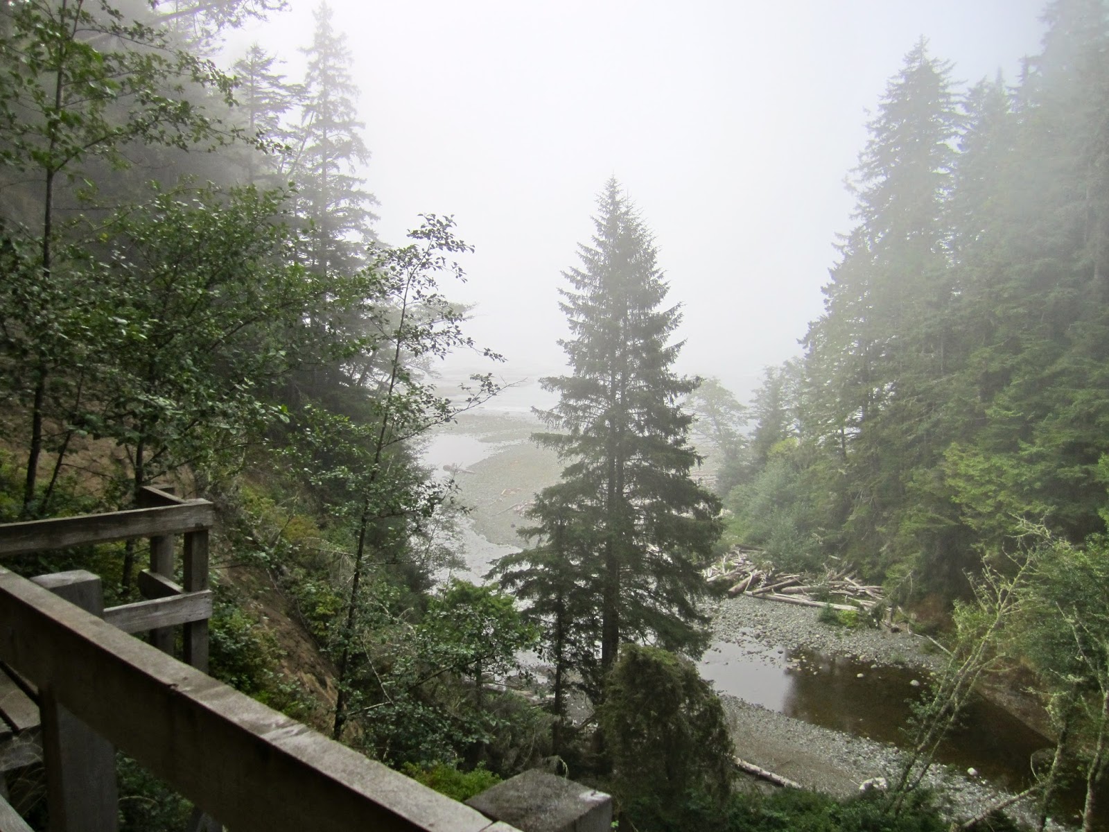
As I approached my first campsite I ran in to some fog as I hiked the shelf at low tide. I had to wade Darling River before I could take off my pack and set up camp.
 |
| First night at Darling Campsite |
Note that I was unable to find two trees so I was forced to work with a piece of driftwood that had been lodged into the sand.
Day 3 (Darling - Ditidaht luxury tent 16 kms)
 |
| Fresh bear prints on the beach heading the opposite direction, one big, one small. |

 |
| Trail guardian cabin |
 |
| These are posted at all the high spots as a safe place from any impending tsunami. |
 |
| In many places the trail is overgrown and the vegetation has created these tunnels. |
 |
| Derelict Grader |
 |
| Derelict Donkey Engine |
 |
| Mud, mud, mud |
 |
| Klanawa River |
 |
| Ladders to Tsusiat Falls |
 |
| Tsusiat |
 |
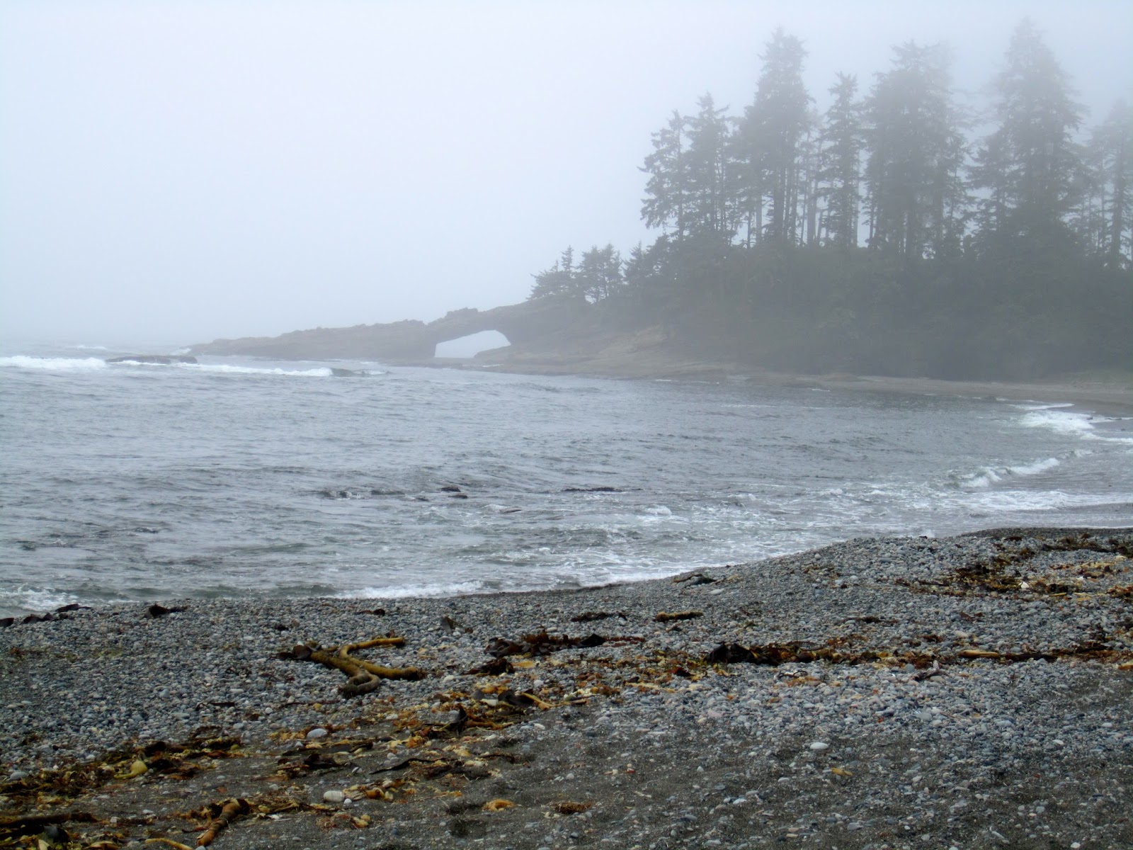
| Hole in the wall |
 |
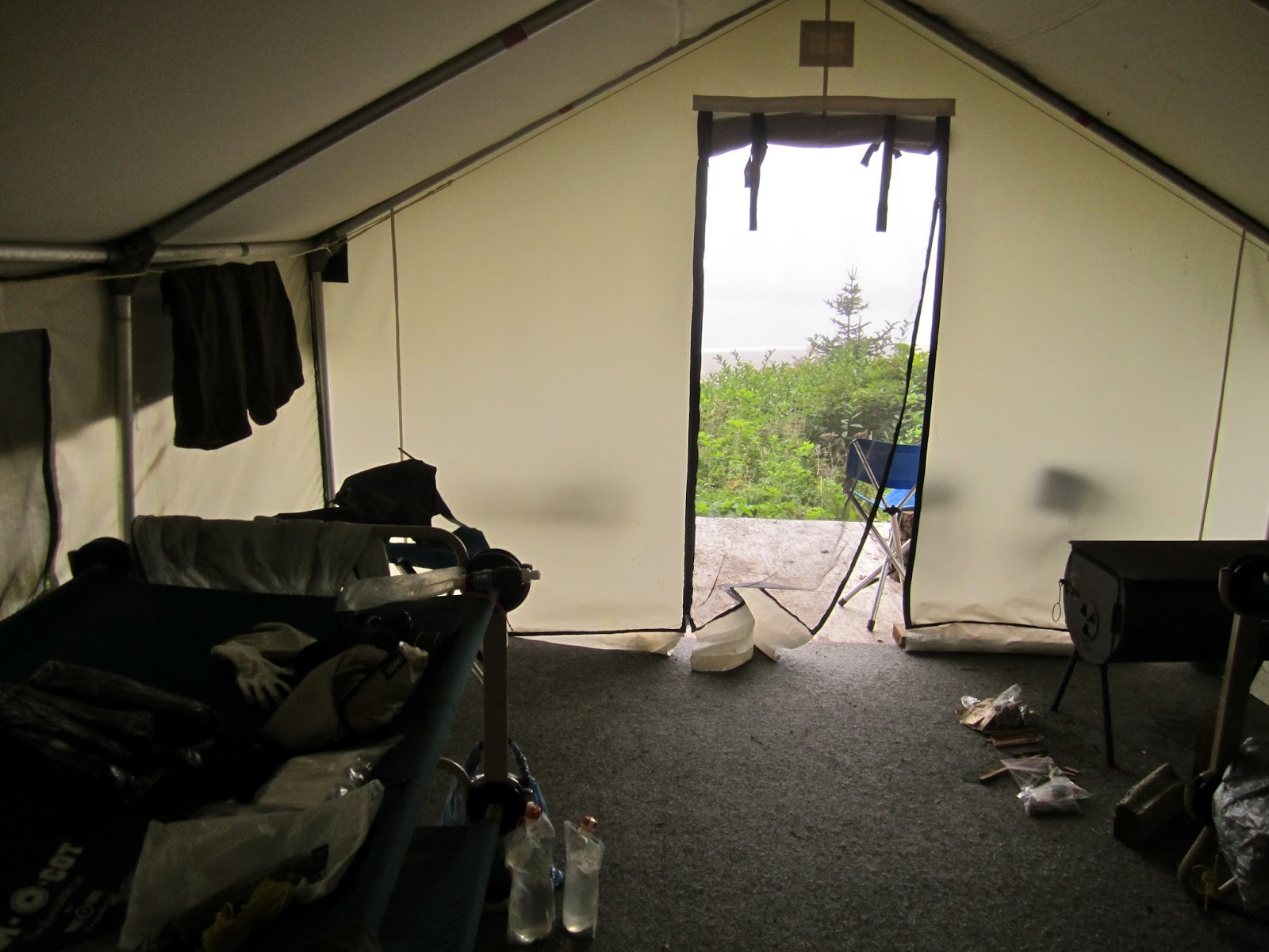
| Ditidat Luxury Tent, a great chance to dry all my soaking gear, which was great since it ended up being the wettest night current cost $60 / tent, being alone meant eating the whole cost. |
Day 4 (Ditidaht luxury tent - Bonilla Creek 18 kms)
 |
| Nitinat Narrows |
 |
| Lunch |
 |
| The West Coast's version of a trail. Roots, roots, roots |
 |
| Bridge over Cheewhat River |
 |
| Yours truly hiking the low tide shelf |
 |
| Carmanah Lighthouse |
 |
| The famous $24 Chez Monique fully loaded burger, really at this point you'd pay anything for this. |
 |
| happy hiker |
 |
| Bonilla Creek, favorite campsite |
 |
| Fellow hikers met along the way, 3 brothers also from Calgary. Mostly we stayed at the same sites but hiked at our own pace, which still meant solo for me. It was nice having some one to talk to in the evening, with out it, being over tired and alone can become quite depressing. |
 |
| Fire really helps moral |
 |
| Hammock found along the way, quite comfortable really. |
 |
| Night 3, best location found for hammocking. I really like Bonilla. |
Day 5 (Bonilla Creek - Camper Creek 14 kms)
 |
| Mud and roots oh ya still smiling |
 |
| Suspension bridge over Logan Creek |
 |
| Insane ladders leading from the bridge, this ladder is not only going up but it is slightly angled so you fill light you are going to fall off sideways. |
 |
| Sand Stone Creek |
 |
| Banana slug, average size is as big as your hand. |
 |
| This is the trail, choose your own adventure |
 |
| Camper Creek |
Day 6 (Camper Creek - Gordon River Trailhead 13 kms)
 |
| For much of this part of the trail these logs are the trail |
 |
| and some bridge a fall you wouldn't enjoy |
 |
| 10 kms to go |
 |
| The old bridge, viewed from the new, you can't tell but the old bridge spans an incredible drop. |
 |
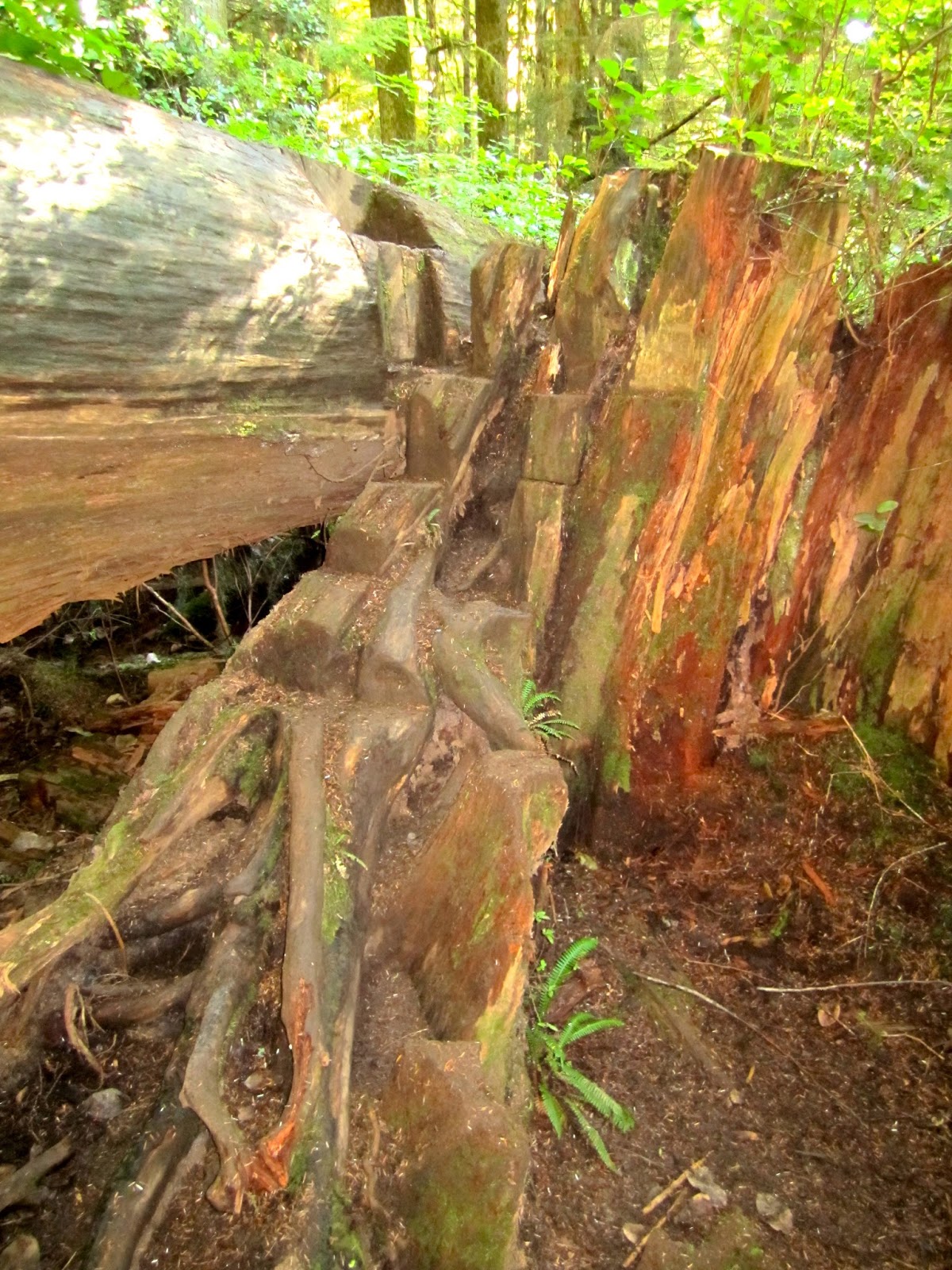
| Stairs carved into these old logs, the height of this is approx. 8 foot. |
 |
| 5 kms to go, still smiling |
 |
| Derelict donkey engine 2 |
 |
| The crack in the rock you see is the trail |
 |
| 1 km to go |
 |
| The trail comes to an end |
 |
Ferry to official trailhead, still smiling.
The group behind me is a YMCA youth group that spent 18 days hiking what I did in five |
 |
| Gordon River Trailhead |
 |
| My lodging for the next two nights, the hiker huts located in Port Renfrew. |
Day 7 Port Renfrew
Unfortunately when you come off the trail two days early unplanned you may get stock in the beautiful but relatively empty Port Renfrew. Her are some of the sights one can find while passing the time.