Originally the plan was to hike 153.7 kilometres (km) to Coleman; due to injuries and needed medical attention our trip was cut short but in no way was our experience diminished. From this experience and others in my life, I have had confirmed to me the reason we set high goals is not to expect failure, but to reach our fullest potential. Every big adventure comes with risk, on some you come through scratch free, others you get a few nicks and bruises, and then there are those that knock you straight on you back side; regardless of which you experience, the real adventurer brushes themselves off and plans the next one, sometimes it just takes a little longer to heal in the interim.
On Friday August 15th Kathy, my wife, took my son's down to Waterton National Park so that she could obtain the permits we required to spend two of our nights in the park as well as pay for our ferry ride to the trail head of our hike. Thank you Kath for all you do in supporting me in all my crazy wanderings.
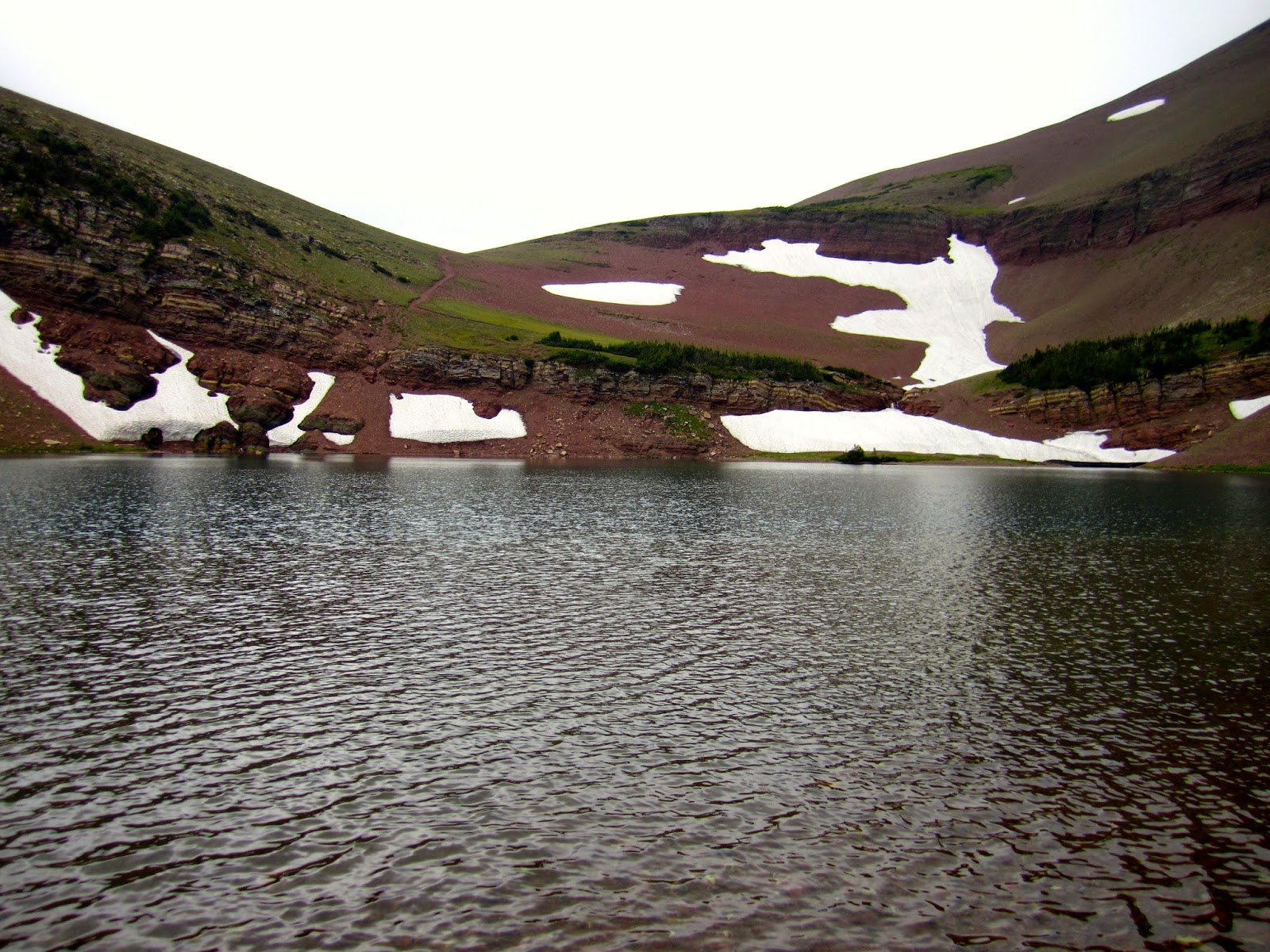
We arrived in short order and met Kathy, Cindy and the boys for lunch at Subway, why not "eat fresh" one last time, right? After a leisurely lunch we headed back on the trail for a 6.8 km uphill climb to Alderson Lake, our spirits were high as we got our first taste of long up hill traverses. We were winded by the time we arrived at the lake but it was so beautiful that we quickly forgot all the struggles of the sloped forest we had just emerged from. The lake was wrapped on three of its sides by Mt Alderson, a majestic wall of rock that filled our entire view as we sat at its base by the lake.
 |
| My Solo Plus tent from ZPacks. com |
 |
| Steve's accommodation |
 |
| Doug's accommodation |
 |
| The wall of Mt. Alderson |
 |
| The beautiful Alderson Lake |
After a quick supper we enjoyed some time sitting by the lake feeling the new aches that now reminded us of our mortality. For a short time we sat on the shore line day dreaming of what was in store. The revelry was cut short by an on again off again light rain that drove us to our shelters for early bed. We all slept well that first night to awake refreshed for the continuation of our trek. This site was quite popular, full of hikers, we shared our night with the largest group we would see for the remainder of our hike.
Day 2 - Alderson Lake Campground - Random Camp along the Cameron/Dipper Trail - 16.9 km
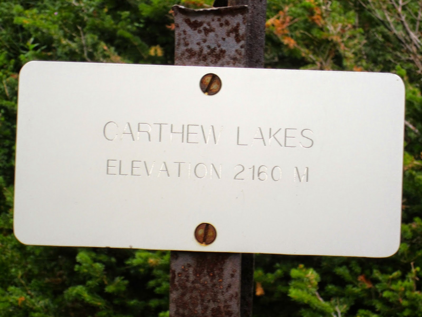
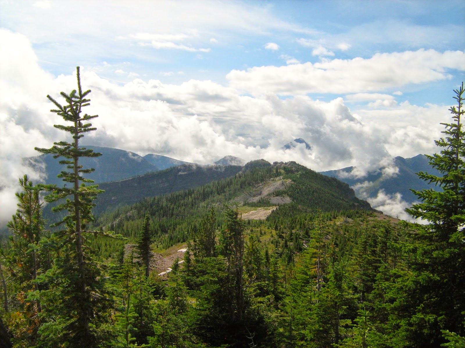
Day two started with a leisurely breakfast which was meant to give us the needed energy to get us up our first steep climb to the summit of Mt. Carthew. Along our way we scramble up a cliff band to the the Carthew Lakes, it was well worth the effort to reach these beautiful lakes that are hidden from view to those that will not climb. The pictures I have, do not justice bring to the spectacular presence these lakes bare. Each lake is out of view until you've put in the effort to get above them, then you are held in a type of trance as they seem to call to you as the sirens of sea, first one then the second. After pulling away from our view of these bewildering sisters we looked up to the open shale covered ascent of the summit (2630m), this is daunting to anyone afraid of heights but with one foot in front of the other we struggled up our first real challenge. The pass does indeed deserve it's prestigious title of " Carthew Summit" because of the magnificent view one has from this point in the mountain ranges of Wateron Nation Park, it is truly a king amongst peers.

 |
| Looking back at Alderson Lake |
 |
| Three Amigos above the Alderson Lake |
 |
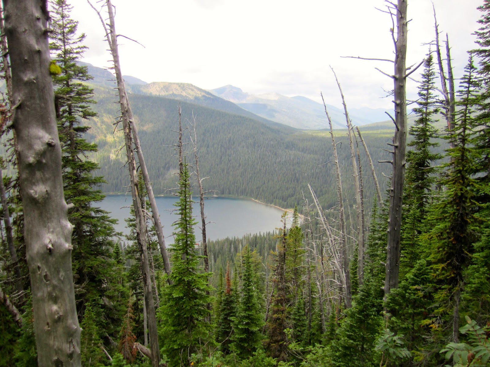
| Lower Carthew Lakes |
 |
| Upper Carthew Lakes |
 |
| First view of the approach to the summit |
 |
| The wild life was quite ferocious |
 |
| Looking back at the Carthew Lakes |
From the summit to Cameron Lake on the other side we found long sweeping switchbacks on open scree that slowly brought us down, captivated by the views of the surrounding area that made it difficult not to fill ones camera in the one day. Eventually we entered tree line but because of the slope of the mountain we rarely lost view of the lakes below. In route to Cameron Lake we past the small crystal clear Summit Lake, but did not stay long anticipating the treats we could buy at the over crowded docks of the much larger Cameron Lake.


We were tired from our climb which is why we lingered longer then we really wanted in this over populated marina, but after resting up we headed back to the trail which began on the Akimina Parkway. We were now quite sore after the strenuous day of climbing. We assumed we would eventually get used to our pack weights and pushed on up the road. After a short walk we came to the intended off shoot to an off trail campsite, Akimina Creek Campground, which we quickly decided was 5kms we could avoid by pursuing a random camp 4 kms ahead along the rarely traveled Cameron/Dipper cross country ski trail.


Along this over grown trail we started seeing our first signs of fresh bear tracks (very fresh). We began to wonder if we had made the right choice in abandoning our original plan but were too tired to turn back. It took a while to find an area that would work for spending the night, open ground but hidden from the road, water near by and trees appropriate to hang our food. When we finally found what we were looking for, the rain began in earnest. We quickly set up camp, ate our quickly prepared dinners, struggled to hang our food and eventually crawled into bed out of the rain. I think we all slept well when we weren't thinking about the prowling bear we knew was close at hand.
 |
| morning view from the tent |
Day 3 - Random Camp along the Cameron/Dipper Trail - Lone Lake Campground - 19.9 km
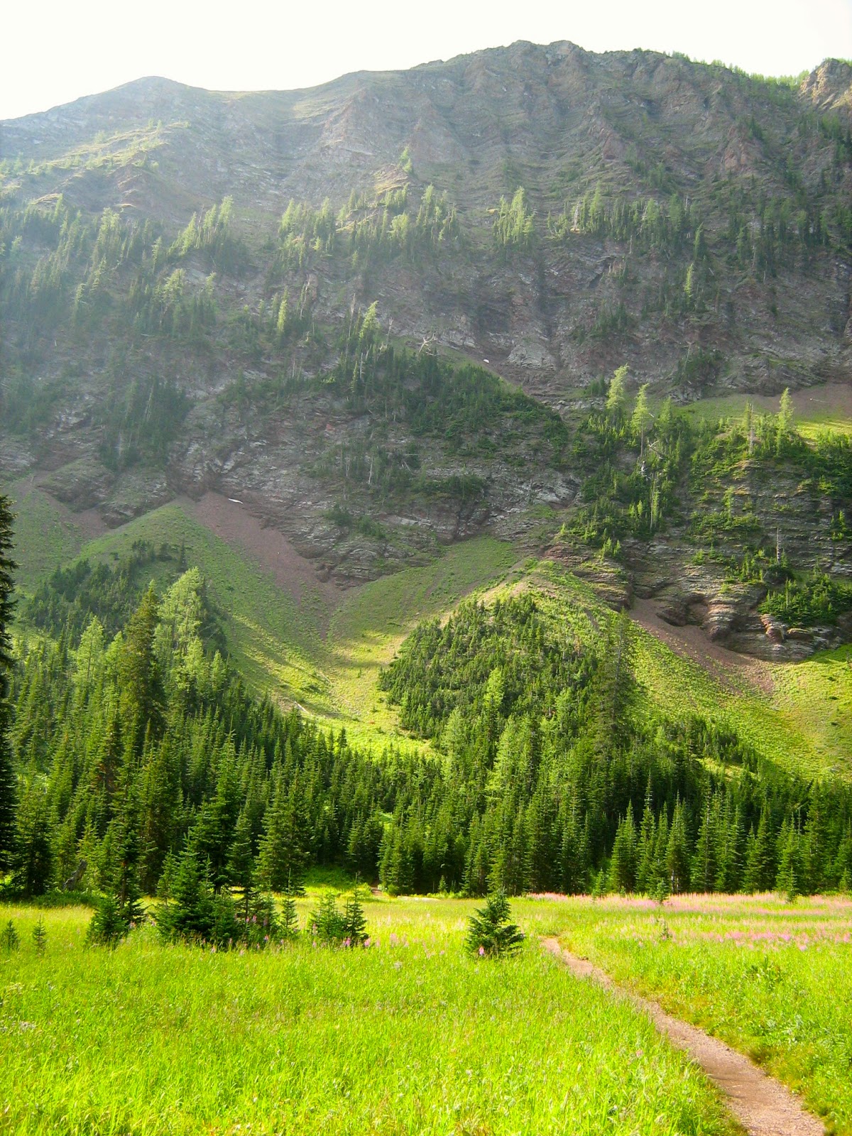
After a wet night we packed our wet tents away and headed for the Rowe Lake trailhead (1605 meters, 5266 feet). This day was mostly climbing again along switch backs ascending to the west through the forest. This section of trail is well maintained and easy to follow for the whole day, unfortunately easy to follow does not mean easy to hike. This strenuous climb also known as the Tamarack Trail, stays high above the north bank of the Rowe Creek and eventually passes a sign for a path leading to the Lower Rowe Lake. Passing by, knowing we'd have a view from above, we came to the beautiful Rowe Meadow and see the mind blowing route ahead.
 |
| Entering Rowe Meadow |
 |
| Steve realizing what we're about to do, oh boy. |
 |
| Early view of Tamarack Summit |
Filling water bottles at a small footbridge over the small brook that provides our last water source for the next 9.2 kms, we psych ourselves for whats ahead, an almost straight vertical climb to a treacherous scree traverse that switches back and forth to the summit. Lets just say we seriously miss judged how much water we would need to get over the tallest peak we would face for the rest of our long hike. (2565 meters, 8416 feet) This climb was intense both for how hard it was but also for how dangerous it was. After climbing vertically we then had to be sure the wind didn't blow us off the loose shale covered mountain.
At this point we met some of the locals, we were mocked by both big horn sheep and mountain goats, I could almost hear their jeers, I could certainly smell them. For me this was a big decision time, one I had been thinking about for days, face my fear of heights and carry on or turn back and fail both myself and my partners, I'm glad to say I battled on with a lot of help from my good friends Steve and Doug.
Having climbed 3150 feet in 8.8 kms to Tamarack Summit we were completely winded but forced ourselves to stop and take a few pictures of the 360 degree view, unbelievable and impossible to put into words. We were on top of the world sucking in the precious little air that seemed so thin, I for one was feeling very dizzy, my vertigo was in full effect.
 |
| View of upper Rowe Lake |
 |
| Scree traverse |
 |
| Big horn sheep up close, we were within throwing distance |
 |
| I don't think they enjoying being disturbed |
 |
| The trail ahead |
 |
| View of both upper and lower Rowe Lake |
 |
| Upper Rowe Lake |
 |
| The Rowe Lakes |
 |
| A look back along the Tamarack Trail |
 |
| Approaching the summit |
 |
| A look back at the ridge we had just hiked |
 |
| Approaching summit looking North |
 |
| Mountain goats that had just come up the sheer cliff wall to their left |
 |
| Summit looking West |
 |
| Summit looking South |
 |
| Summit looking South East |
 |
| Summit looking East |
This day was a challenge to my fear of heights but having accomplished it, I found it prepared me for what was ahead. Struggling with this overwhelming fear I starting hiking, hoping my companions were following me back down the other side along long switch backs over more loose shale towards our next nights much needed sleep. While some might think down hill should be easier any one that has done any real hiking knows that while it may be faster, it tends to deal a harder beating on your body then going up, everything hurts, gravity beats you up relentlessly, I think this is where Doug's feet first started to feel the impact of boots that were just a little too tight. I believe he has finally lost his big toe nail which surprising hung on for some time, on the trail it looked bad, very bad.
 |
| The faint trail off the summit heading west |
 |
| A look back at the summit we had just been on |
 |
| A bit of shade where we ate a little lunch |

We ate lunch and ran out of water well before reaching our next water source, but eventually we found it and it gave us the strength to grunt out the remaining kilometres to the last campsite we would share with other hikers, in fact this was the last time we would see anyone on the trail till we reached our exit point. At this point I was starting to struggle with forcing myself to eat, I did not feel well and could not bare adding food to my already upset stomach. With this I knew I also needed calories to carry on, this conflict continued through out the evening and on throughout most of the next day. My friends were concerned and were kind in suggesting maybe we should look for a way out but I felt I could not stop now and felt a strong need to move forward so I insisted that we do just that. I did not sleep well that night with my empty angry stomach. The next day with little strength due to the lack of calories and sleep I stumbled on with my poorly thought through decision.


 |
| First view of Lone Lake |
 |
| We found this gangster just chillin |
 |
| Our Flintstone style dinner table |
 |
| Our first chance at a camp fire, it was comforting |
 |
| Our last real food hang, at our last official camp ground in the Park |
Lone Lake campground was a remote place that shared company with a beautiful lake on one side and shear cliff drop on the other overlooking the valley where the Lone and Blakiston creeks meet as they continue East back to where we had come. In the morning we were leaving the safety of the Park, the feeling of entering the relatively untraveled sparse trail brought mixed emotions, we were really doing this.
Day 4 - Lone Lake Campground - Jutland Brook Campground - 21.4 km
Thankfully the 7.3 km section of trail from Lone Lake Campground to Twin Lake Campground was relatively moderate and very beautiful. The meadows were spectacular but brought with them some reservation knowing that they were the perfect environment to find bears. We were fortunate to only see signs of their presence but never them directly.
 |
| Doug enjoying the view |
We stopped for an early lunch, which I could not force down, but the rest was nice. From here we started to climb again, ever approaching the boundary of the Park at Sage Pass, we were starting to get our climbing legs and made good progress. We stood on the Continental Divide and the Waterton Lakes National Park boundary with the Cranbrook Forest District in British Columbia. We saw our first boundary sign at the pass and realized few people ever came this way. The trail also became much fainter in fact at times we lost it entirely.


We descended to a remote outfitter's camp in a sparse forest. Two very meagre springs were our last water source for 6.9 kms, we knew from the previous days experience to load up and we did. From here we had to climb to an unnamed pass which we could see through dense forest but could not find the trail. We spent easily an hour bushwhacking up hill before we finally found our trail only just before reaching the ridge crest leading to the unnamed pass we were looking for. This was our first experience with trail finding and it would not be our last.


Now high above the Lost Lake on the Divide, the ascent steeply continued up the BC side until we reached this days highpoint of 2360 meters (7743 feet) before rejoining the crest. We follow the crest for a ways until we reached a peculiar canyon boulder field on the ridge top. We followed this canyon slowly descending along the crest until we reach a very steep descent down some tricky boulders. Again keeping track of the trail was almost impossible in all the boulders. At the bottom of our descent we reach another outfitter camp and our next water source.
Due to time we contemplate dinner but just snacked instead, I really wasn't ready to eat anyways, it had now been 36 hours since my last real meal, I was fading quick. We had 5.2 kms to go and I just wanted to reach camp and sleep. Up and down we went, the kilometres slowly melting as the sun quickly sank but we made it and celebrated in the small clearing that was Jutland Brook Campground.


You might think this is how our day ended but we we're in store for a long evening. The site was inviting and quite beautiful but there was not many flat areas to set up a tent even ones as small as ours, but eventually we figured it out. Steve decided we needed a fire, it had been raining off and on all day and there was not a lot of dry wood but Steve being a fellow scouter new what had to be done and performed perfectly. I new I didn't have the energy to even attempt it, but I guess thats why I didn't do this adventure alone. The fire helped morale, and finally I felt hungry enough to actually eat my supper. Just eating my small meal boosted my energy, albeit nervous energy.
 |
| Jutland Brook Campground |
 |
| Some times you just need a fire |
At this point we realized we had very few spots to hang our food and it was now getting quite dark. In the clearing there was one tree with few branches and we some how strung our food up with the help of our head lamps, Steve stoked up the fire and it was time for bed.
We had not been in bed for more then 30 minutes when we hear the distinct sound of a large animal's growl, the kind that leaves you frozen and acutely aware that you are out in the middle of nowhere. The growl was just outside Steve's tent which was 50 metres from my tent and I heard it like it was just outside of mine, with this K9 sounding growl Steve shouted out to us "BEAR BANGERS, BEAR BANGER, FIRE YOUR BEAR BANGERS", Doug and I did just that and we assumed we solved the problem and laid there at full alert until about 15 minutes later when suddenly I could hear just behind my tent a very large animal chewing on what I assumed was a smaller animal. I could hear bones and sinew crunching and it lasted for some time.
The 3 bangers had not scared it away so we ruled out bear and starting thinking Cougar or Wolf. The growl sounded to me like that of a large upset Dog that you might have tried to steal something from, it was a warning growl and I personally believe it was not alone. At this point I was exhausted and resolved that I had to sleep and as long as this animal had something else to eat, I was hopefully off the menu. With bear banger reloaded and bear spray ready at hand, I slept deep. I can not say how my friends faired, but I slept as though I was dead. The next morning came too fast.
Oh, did I forget to mention that earlier this day, about lunch time one of our crew reported he was peeing blood which lasted and continued to get worse as the days progressed, I won't go into any details but this medical emergency had us all very concerned for the health of our companion and eventually led to our early exit of the trail when it was both possible and safe, but that wasn't for another 2 days.
Day 5 - Jutland Brook Campground - West Castle Rd Random Camp - 15.9 km
Don't let the lower kilometres fool you, this day almost killed us, and it took us 16.5 hours to complete.
We started late this day, which was kinda becoming a trend, however on this day we should not have let this happen, regardless we finally hit the trail at 9 am, little did we know that we wouldn't finish our day till after 1:30 am the following day.
As we started hiking out of the valley to our first ridge we found signs that indeed we had been visited by wolves, paw prints of multiple sizes as well as obvious scat. We climbed to our first ridge and then the trail began to go faint again; managing to follow it to our first summit we lost it all together just before we had ascend.
One of the bigger obstacles of this day was the fact that there were no sources of water along the way, we had to cover over 12 kms over high peaks and passes so we took the opportunity to fill all our containers at the head of the Scarpe Creek.
Having lost the trail, once again we found ourselves bushwhacking straight up some very treacherous terrain, we did not come out unscathed. I 'm sure the climb shouldn't have been so steep but the way we took was certainly nerve racking. At this point we arrived at the unnamed pass we were looking for and never did find the trail, with our maps and GPS we continued to follow our noses up the very steep mountainside to the west encountering some scree close to the Coulotte Ridge Crest. On the crest is where we finally ran into the faint trail, mainly due to the lack of options.
La Coulotte Ridge has a windswept shale crest with sparse vegetation, from here the ascent started moderate but eventually became steeper as it neared the first of three summits that make up the La Coulotte Ridge. After ascending the first we descended steeply on the crest taking care not to lose our step and begin a long ride to our deaths. We started climbing again, the second peak was not as bad as the first but still a healthy climb. At this point the views are incredible reaching all the way to the US border.


The cross country route continued down to a lower pass leading to a final push over difficult scree that would bring us to the summit of La Coulotte Peak (2430 metres, 7973 feet) on the Continental Divide. At this point we decide there was no way that we would come out of these mountains before dark without making a few adjustments to our route. About half way up La Coulotte Peak we decided we could bypass the huge climb by traversing the side of the mountain. While this looked doable there was no defined trail and the self made route proved challenging.
This is when all hell broke loose, about halfway along the mountain side the rain and then golf ball sized hail started to pelt us on the sparsely covered mountain. We stopped to seek poor covering under the one tree big enough for the three of us to hide our heads from the storm, the rest of our bodies had to suffer the endless stinging strikes of the hail. At this point we didn't think things could get worse but we were wrong because this is when the thunder and lightening began, striking so close that the light and booms were only a second or two apart. We could smell and feel the electricity in the air. I recall looking into the eyes of my companions; two more peaks to climb ahead along with a lot of kilometres, thinking we were dead men.


After a couple prayers the lighting eventually subsided and we decide to move on even if it was still hailing. The going was extremely slippery on a slope that would kill if we gained momentum in a fall. We eventually met the trail as it slowly came down from the peak, we were all glad we weren't on the peak in that storm but felt that we lost a lot of time struggling along the side of the mountain with no trail to follow.
As we reach the unnamed ridge that led to the next peak we had to climb, the rain and hail finally stopped and after a brief clearing the fog rolled in obscuring the view all around us, this and the wet weather is the main reason not many pictures were taken during this section.
The steep ascent up the crest of the next unnamed peak to the west rewards with a easy walk across the long summit ridge, however when I say steep ascent, I mean steep on a terrible trail. Each step was inches away from a drop that would end it all in an instant, for some bizarre reason the trail didn't follow the middle of the climb but right along the edge. Along with the impending drop was a trail strewn with small loose pieces of wet shale that gave no sure footing, every other step was a slip step where you felt like you were going down. At this point I was no longer worrying about myself but for my fellow hikers, what would I do if one of them went over the edge, I knew I would have no choice but to carry on so that I could report and send a recovery team for the body of my friend. These were dark thoughts that plagued me as I hiked. In the back of my mind was the recent news of the girl from Edmonton that had just the week before fallen to her death from these very mountain peaks doing much as we were.
Lethbridge Herald
Once we reached the top of this peak the promised easy walk along the ridge top was like hiking a knife's edge where there was straight drop off either side of the trail. The fog was making it challenging to follow the trail and we had to move cautiously so as to not step off the edge. The fog made it hard to tell how much further we had to go before we could get off these mountains.
After a moderate descent off the ridge we had one final climb to a peak that was a mix of moderate and steep climbing. As we approached this final climb we new a couple things; we were beat, we were out of water, the sun was going down and we had well over 7 kms before we would reach water and 10 kms to our planned camp site. By a miracle just before this ascent we found snow, this snow was added to the few swallows of water we had left and was put close to our bodies so as to have water down the trail. After filling our bottles we climbed and finally reached our final peak.
From here we descended to very narrow ridge that was meant to lead off the mountain, we followed a trail we felt was correct to later find out that we had chosen poorly. We came off the mountain probably 50 - 100 yards too early but this decision added over an hour of cross country bushwhacking that was pure hell and ate up all the light we had left in the day. By the time we climbed back up to the correct trail, an old ATV trail, it was totally dark and thats when the heavy rain really hit.
We had 9.5 kms to go and we were hiking like zombies. The rain became so bad that the trail started to represent a river rather then a trail and we were stumbling in the dark hoping we were on the right route. Thankfully we were and we followed each other through the dark heavy rain until we came to a river ford which by this point was almost knee high.
After crossing the ford we thought we had a little ways to go so we stumbled past the tiny clearing just past the water. After refilling our water bottles we hiked approximately 200 meters when we realized we had passed our destination and that small clearing was likely our camp, so we turned around.


By this point we were soaked through and new we would not be able to set up our shelters in all the rain with out making things worse. Having experienced late stages of hypothermia myself I knew we were all showing signs of dropping into it quickly. At this point I decided we had one option, set my tarp as quickly as possible, get under it, shed all wet clothing, change into anything we had left in our packs that was dry. This plan worked and worked well, it took time but by 1:30 am we were all in our sleeping bags finally warming up, all huddled together under my tarp that I decided to bring at the last minute. We got a few hours sleep and awoke the next morning to the rain that never let up.
Day 6 - West Castle Rd Random Camp - Castle Mountain Ski Resort - 12 km
While this section of trail is an easy walk along relatively well maintained terrain, we felt like we could hardly move with all the aches and pains we were suffering. Eventually the rain did let up but not till we had been on the trail for a few kilometres. It took a while but we got back in our hiking rhythm and made descent time to the arranged B&B we planned to stay at, however we decided it would be best if we returned home as soon as we could so that our health concerns could be properly diagnosed. The Heaven Bound B&B was awesome and they understood our need to change our plans, they fed us a great supper and let us have showers and let some of our gear dry out by the fire.
Conclusion
All in all we had an awesome adventure, we faced challenges that perhaps we were a little under prepared for, but in the end we all survived to tell the tale. I'm so glad that I went with the two pals that I did, they made what could have been a disaster into a fond memory I will never forget. Thank you Steve and Doug, can't wait for next year.


Thank you for posting your story. I have read a few tales of hiking adventures, but your story was full of difficulty and danger. You described it in a way that I could really feel your suffering. It's inspiring also how you felt safe with your companions and pushed through your fear of heights. Well done. Thank you for sharing.
ReplyDeleteThank you for your comment Josh, I am glad you enjoyed it.
Delete